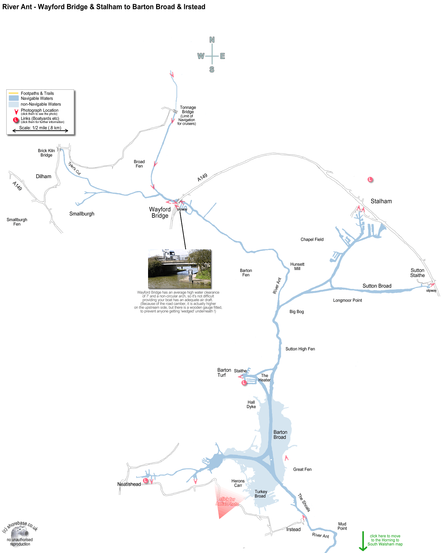
This page contains a scale map section of the Norfolk Broads.    (c) shorebase.co.uk
It is larger than your screen, so you will need to scroll the page to view it all.
Although hand-drawn, it is to the scale shown, and the positioning of the rivers and broads is accurate.
Wherever your mouse cursor changes to a pointer, 'popup text' will give more information.
The red angles are 'hotspots' for photos taken at that point, which you may then click to display them.
The other red markers are 'hotspots' to businesses & web links at that point, which you may then click to view.
If the photos or links don't appear when clicked, it may be caused by 'Advert Blocking' in your browser or firewall.

move to next map Looking downstream under Wayford Bridge, close to the limit of navigation for the River Ant. Although the clearance is a little low (at 7 foot average high water), it is not arched, so is not so difficult as Potter or Wroxham. Looking West along the River Ant upstream of Wayford Bridge. The view from wayford Bridge looking downstream on the River Ant. Looking south down Stalham Staithe towards the connection with the River Ant. Part of the Museum of the Broads can be seen on the left bank. Barton Turf near Barton Broad. Looking eastwards across the staithe towards the River Ant. Neatishead Staithe, facing North. The waterway bears right into Barton Broad Irstead Staithe facing south, downstream on the River Ant. Broadland Angling & Pet Centre Cox''s Boatyard Limited Tonnage Bridge, along the North Walsham and Dilham Canal. Kayaking along the North Walsham & Dilham Canal, just above Wayford Bridge. I am paddling the <i>Folbot Aleut</i>, following a <i>Folbot Super 17.</i> Paddling along an overgrown section of the North Walsham and Dilham Canal, just above Wayford Bridge. (The Kayak is a Folbot Aleut, a US produced folding kayak.) The public launching slipway at Wayford Bridge. The use of the slipway is free, but is only suitable for dinghies and canoes, as there is limited space in the dyke. The parking is also free, but space is limited, and it fills up quickly during busy periods. Sutton Parish Slipway, adjacent to Sutton Staithe. Parking for cars and trailers nearby, launching fee charged by Parish. Stalham Staithe, with the Wherry   Maud   tied up alongside the Broads Museum. Barton Broad from the South West. The channel into Neatishead is at the bottom left, and Stalham & Sutton are just visible in the top left hand corner.  Ra , the solar powered catamaran operated by the Broads Authority on Barton Broad, seen here just leaving Gays Staithe. Catfield Fen Nature reserve runs along the eastern edge of Barton Broad. It is accessible via the narrow country lanes to the West of Catfield Church and Village.