This page contains a scale map section of the Norfolk Broads.    (c) shorebase.co.uk
It is larger than your screen, so you will need to scroll the page to view it all.
Although hand-drawn, it is to the scale shown, and the positioning of the rivers and broads is accurate.
Wherever your mouse cursor changes to a pointer, 'popup text' will give more information.
The red angles are 'hotspots' for photos taken at that point, which you may then click to display them.
The other red markers are 'hotspots' to businesses & web links at that point, which you may then click to view.
If the photos or links don't appear when clicked, it may be caused by 'Advert Blocking' in your browser or firewall.
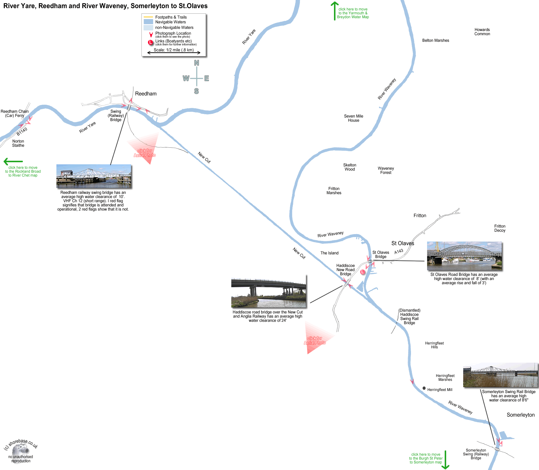
A view of Somerleyton swing rail bridge from the downstream (northern) side. The River Waveney looking downstrean, 100 yards North of Somerleyton Rail Bridge. move to next map move to next map move to next map River Waveney, near Somerleyton, looking downstream (north). A view of the New Cut facing north west from the elevated road bridge. Reedham is visible on the skyline in the centre (2½ miles away), and Cantley sugar beet factory is on the left (5 miles away). A view of the New Cut facing south east from the elevated road bridge. The junction with the River Waveney is visible, with the old signal box to the dismantled Haddiscoe Bridge to the right of the picture.. St Olaves Bridge, from the upstream side. The River Waveney at St Olaves looking upstream from the Bridge. Johnsons Yacht Station is on the right-hand bank. The River Waveney, downstream of St Olaves Bridge. Looking southeast down the entire length (2¾ miles) of the New Cut from Reedham. Reedham swing railway bridge over the River Yare from the downstream side. The village and staithe of Reedham can be seen through the arch. Looking southwards across Reedham swing bridge over the River Yare. River Yare at Reedham Staithe, looking upstream. A group of Hunters Yard yachts, downstream of Reedham Ferry. Reedham Chain Ferry, crossing the River Yare The River Yare facing upstream from the Reedham Ferry. (The two yachts are from the Hunter Fleet, based at Ludham). St.Olaves, with the New Cut and Haddiscoe bridge in the foreground. Scroby Sands wind farm at Great Yarmouth is just visible on the horizon right. Reedham village, with the swing bridge in the centre and the north east Norfolk coast in the distance.