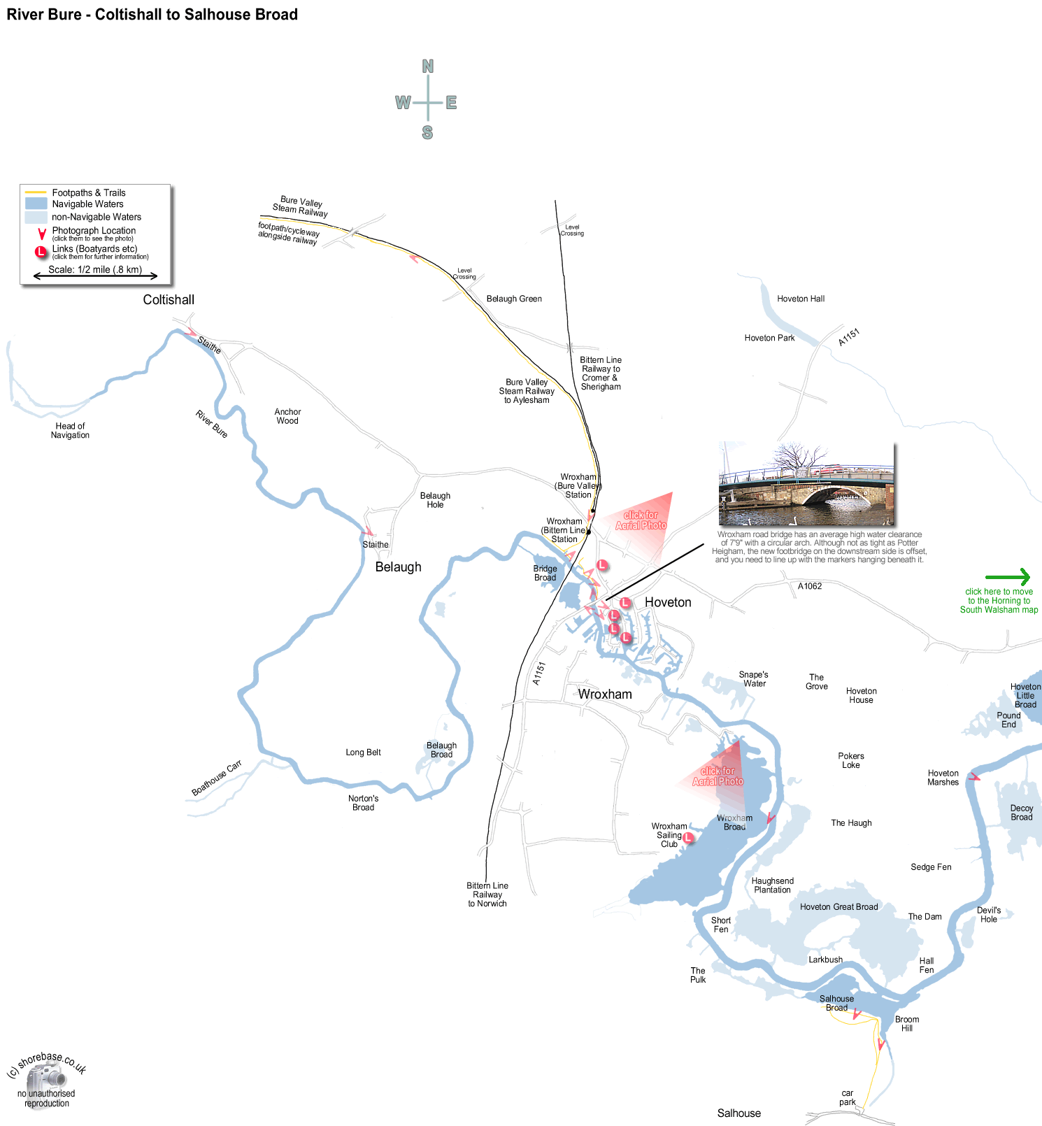
This page contains a scale map section of the Norfolk Broads.    (c) shorebase.co.uk
It is larger than your screen, so you will need to scroll the page to view it all.
Although hand-drawn, it is to the scale shown, and the positioning of the rivers and broads is accurate.
Wherever your mouse cursor changes to a pointer, 'popup text' will give more information.
The red angles are 'hotspots' for photos taken at that point, which you may then click to display them.
The other red markers are 'hotspots' to businesses & web links at that point, which you may then click to view.
If the photos or links don't appear when clicked, it may be caused by 'Advert Blocking' in your browser or firewall.
The river Bure taken from Wroxham Bridge (facing downstream). The new footbridge over the River Bure at Wroxham. The arch is offset from the road bridge and has caused some problems. The newly added height gauge therefore assists navigation. The west (upstream) side of Wroxham Bridge during an exceptional high water period. Although the car in the foreground appears awash, no significant damage occured. move to next map The Bure Valley Railway loco Spitfire on the turntable at Wroxham (Hoveton) Station. Wroxham Road Bridge, River Bure. (the white footbridge has since been changed). (The cruiser is actually stuck under the Bridge!) The River Bure at Coltishall Staithe facing upstream. The picture was taken near the limit of navigation. Belaugh Staithe on the River Bure looking upstream towards Coltishall. A panorama of the River Bure just upstream of Wroxham Railway Bridge. The entrance to Bridge Broad is on the opposite side of the river, and the public 24 hour moorings are on the extreme right-hand side of the picture. River Bure, Wroxham upstream of the road bridge looking west towards the railway bridge. Connoisseur Boats and Bridge Broad are on the left, with the public moorings on the right. One of the River Inspectors launches moored at Wroxham downstream of the railway bridge. Looking upstream on the River Bure, moored to the narrow spit of land separating the River from Wroxham Broad. The Bure Valley Steam Railway loco Wroxham Broad , about 2½ miles north west of Wroxham Station. The photo was taken from the public footpath/cycleway which runs the full length of the track from Wroxham to Aylsham, 9 miles away. A (stitched) panorama of Salhouse Broad taken from the public moorings on the southern bank. The River Bure runs close by the northern edge and can be seen through two of the gaps. (scroll to the right to see all of the photo) The boardwalk leading to Salhouse Broad from the car park on the outskirts of Salhouse village. Wroxham Broad looking South West. The Norfolk Broads Yacht Club is to the right of the Broad, and the River Bure runs closely along the left hand side. Wroxham looking South. The two large flat topped buildings on the centre right are Roys Stores, and the River Bridge is just beyond them. St John  s School is in the middle foreground and the River Bure heads towards Horning at the centre left. Wroxham Angling & Gift Centre Norfolk Marine Norfolk Broads Yacht Club Dydalls Drainage Mill, upstream of Horning on the River Bure.